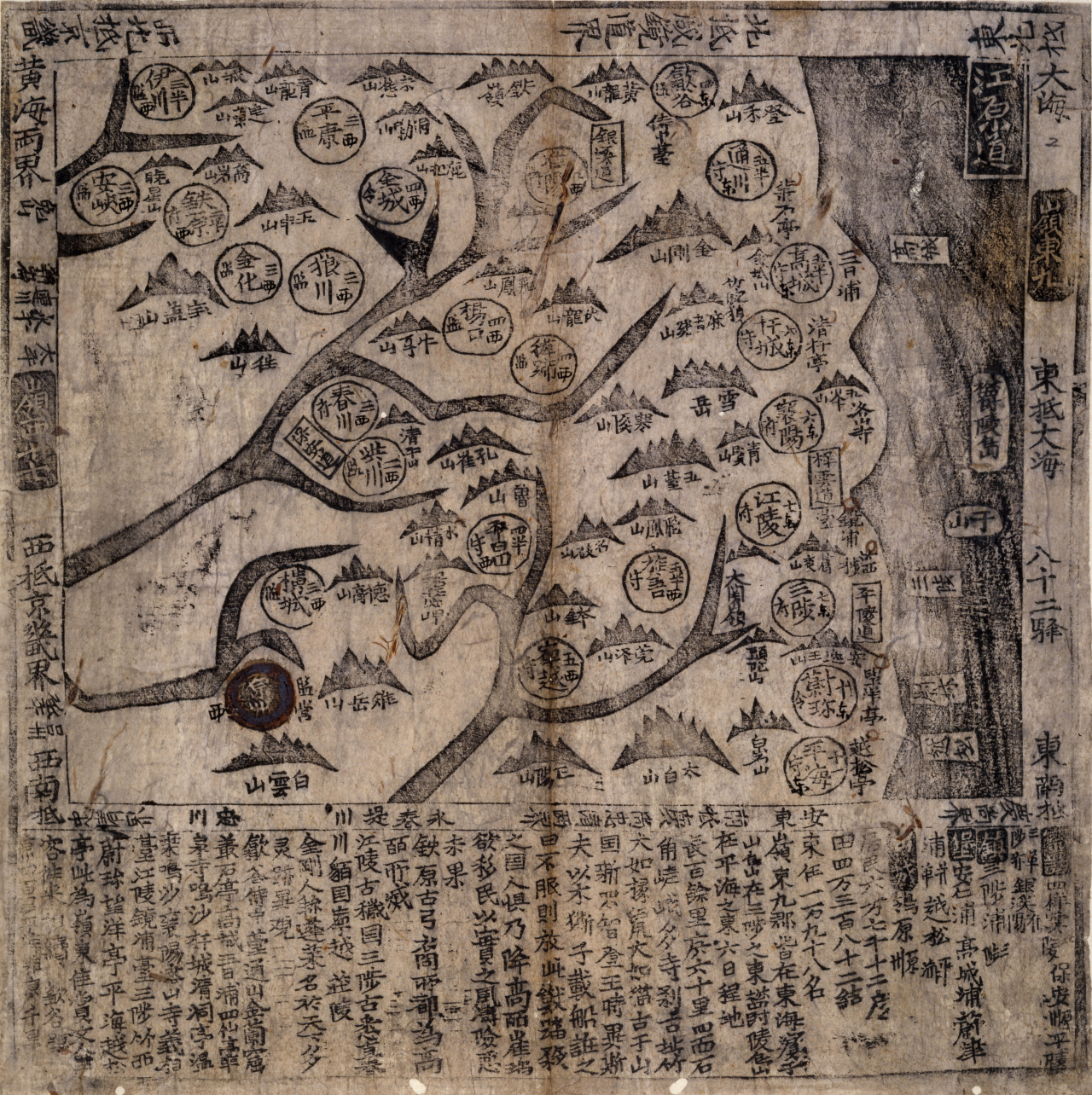
A one-stop online platform has been launched to streamline access to thousands of old and modern maps depicting East Asia, according to a South Korean history foundation Tuesday.
The East Asian Old Map Collection, a website launched by the state-run Northeast Asian History Foundation, brings together a total of 2,212 maps facilitating easier access to thousands of old maps scattered among different institutions.
The maps date as far back as 1592 and users can see how various maps published later captured the same regions, by entering the names of places on the website.
An official at the Northeast Asian History Foundation said it is working on expanding the project to have more old maps available.
“For now, it’s just local institutions we’re working with, but we plan to make it work for people to check out old maps of East Asia that institutions outside of Korea have at their disposal,” the official said.
The push to streamline access to historical documents involving the Korean Peninsula is part of larger efforts by the foundation to raise awareness of what the foundation does among the public. The foundation has been keen on stepping up outreach since last month, when its president openly made that a priority.
Among goals discussed by President Park Ji-hang, instilling an “objective and future-oriented” perspective on history was another. The foundation, launched to set the record straight on shared histories with neighboring countries, could help power initiative to win over the international community to safeguard core national interests, she said.
Park did not specify what those interests might be, but her remarks were seen as pointing in particular to Japan’s repeated attempts to claim Dokdo -- Korea’s easternmost islets in the sea between the two countries. The foundation has occasionally introduced old maps that showed Dokdo under Korea’s control and oversight.
Days after the comments on March 23, foundation researchers convened an unscheduled meeting to discuss the Japanese government’s decision the previous day that endorsed Japanese territorial claims to Dokdo.
Fifteen of the 18 textbooks that were approved by the Japanese government as of this year said Dokdo “is illegally occupied” by Korea. More textbooks carried the description, compared to 2020.
“It will be much harder for Korea and Japan to advance relations based on trust if the younger generation in each country looks at their shared history with bias and distrust each other,” said Nam Sang-gu, director-general in charge of the foundation’s research and policy planning, at the meeting.
Suk Ju-hee, a research fellow at the foundation, added that Seoul should draw up a comprehensive plan to deal with Tokyo’s claims over the island. Participants at the meeting noted that Japanese textbooks are increasingly paying attention to details as minute as textbook pictures showing Dokdo.
The more up-to-date the pictures are, the more likely Japan will continue to double down on its territorial claims, one foundation researcher said of Tokyo’s potential aims.